
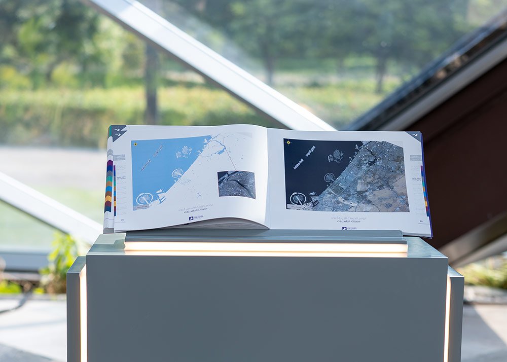
- A comprehensive visual and geographic resource documenting Dubai’s development and providing deeper insights into its geospatial landscape.
- Publication brings together maps, aerial and satellite imagery, and historical data in a single reference covering the emirate’s geographical, urban, demographic and environmental characteristics.
- Launch marks the 25th anniversary of Dubai Municipality’s Geographic Information Systems Centre and its contribution to advancing the use of geospatial data in urban planning, city management and future development.
- Event brings together strategic partners to explore opportunities for collaboration, knowledge exchange and the development of innovative solutions in geographic information systems and digital twins.
- Cooperation agreement explores opportunities to develop digital twin models, integrate geospatial data, and leverage advanced technologies and applied research to support urban planning and informed decision-making.
Dubai, United Arab Emirates, 19 November 2026: Dubai Municipality has launched ‘Dubai Atlas’, a comprehensive geographic and visual resource documenting the transformation of the emirate of Dubai and providing insights into its future development. Bringing together geospatial data, maps, and aerial and satellite imagery in a single reference, the publication explores Dubai’s geographical, urban and natural characteristics, infrastructure and community facilities, providing a detailed understanding of the emirate’s evolution and distinctive identity.
The launch took place during an event organised by Dubai Municipality to celebrate the 25th anniversary of its Geographic Information Systems (GIS) Centre, held under the theme ‘25 Years: From the First Map to the City of the Future’. Organised to mark World GIS Day, the event highlighted the role of geospatial data in understanding, planning and managing cities, and its contribution to more informed decision-making and future urban development.
Mapping Dubai’s transformation
Through maps and aerial and satellite imagery, Dubai Atlas documents the geographical and urban changes that have shaped the emirate over time. The publication also features archival maps that preserve a visual and geographical record of Dubai’s development, enabling readers to explore its transformation and gain a deeper understanding of the relationship between its natural environment, urban growth and infrastructure.
Comprising 10 chapters, Dubai Atlas covers a wide range of topics, including geospatial information, demographics, roads and transport networks, the environment, culture and heritage, religious landmarks, education, healthcare, community facilities and archival maps.
The publication also provides extensive coverage of Dubai’s natural environment and agricultural landscape, including nature reserves, ghaf trees, green spaces, farms, food security, dams and mountain trails. Together, these subjects offer insights into the emirate’s diverse natural and urban landscapes, highlighting their relationship with planning and development.
Dubai Atlas also explores the role of geographic information and its practical applications across several vital sectors. These include urban planning and land management, road and transport network planning, traffic analysis, building management, construction permitting and municipal services.
The publication further examines geospatial applications in emergency response and crisis management, spatial risk analysis, environmental monitoring and natural resource management, alongside emerging applications in smart city development, digital twins, artificial intelligence and big data analytics.
Advancing geospatial knowledge and urban planning
Eng. Maryam Al Muhairi, CEO of the Building Regulation and Permits Agency at Dubai Municipality, said: “Dubai Atlas represents an important addition to Dubai Municipality’s knowledge publications, bringing together geographic information, maps and visual records in a comprehensive reference that enables us to better understand the emirate, document its transformation and explore its future development.
“The publication also reflects our commitment to advancing Dubai’s geospatial data ecosystem, improving the quality and accessibility of information, and strengthening its application in urban planning and city management to support more accurate, informed and proactive decision-making.”
She added: “Our goal is to establish geospatial data as a fundamental pillar of urban planning, operational management and future readiness. By harnessing the capabilities of digital twins and advanced technologies, we aim to develop a comprehensive and interconnected understanding of Dubai’s urban landscape. This will support more efficient planning and resource management, strengthen the city’s ability to anticipate and respond to emerging challenges, and reinforce Dubai’s position as a global model for smart, future-ready cities.”
Strengthening partnerships in geospatial innovation
The event also provided a platform for dialogue and knowledge exchange on the future of geospatial solutions and their applications in urban planning and city management. It brought together strategic partners from government entities and private sector organisations to explore opportunities for collaboration and the development of innovative solutions.
Eng. Maitha Al Nuaimi, Director of the GIS Centre Department at Dubai Municipality, said: “World GIS Day provides an opportunity to strengthen collaboration with our partners and explore new areas for knowledge sharing, the exchange of technical expertise and the development of joint solutions. By bringing together the capabilities of the public and private sectors, we aim to accelerate innovation and develop geospatial applications that respond to the city’s evolving needs and enhance quality of life.
“Through these partnerships, we aim to expand cooperation in digital twins and advanced technologies, strengthening Dubai’s capabilities in applying geospatial intelligence to urban planning and city management.”
As part of the event, Dubai Municipality signed a memorandum of understanding with Mansions Intellecta Technologies LLC to explore future applications of digital twins and strengthen collaboration in technological innovation, applied research and foresight.
The agreement focuses on exploring opportunities to integrate geospatial data and leverage advanced technologies to develop digital twin models that support urban planning, informed decision-making and Dubai’s future development.
The collaboration also encompasses knowledge and expertise exchange, research and development, the identification of emerging technological trends, and opportunities to develop innovative digital solutions that contribute to the advancement of Dubai’s digital twin capabilities and the emirate’s wider digital transformation.